Restr:Claudius Ptolemy- The World.jpg
Mont d’ar merdeerezh
Mont d’ar c’hlask

Ment ar rakweled-mañ : 800 × 576 piksel. pizhderioù all : 320 × 230 piksel | 640 × 461 piksel | 1 024 × 737 piksel | 1 280 × 922 piksel | 2 560 × 1 843 piksel | 8 073 × 5 813 piksel.
Restr orin (8 073 × 5 813 piksel, ment ar restr : 18,03 Mio, seurt MIME : image/jpeg)
Diverradur
| Arzour |
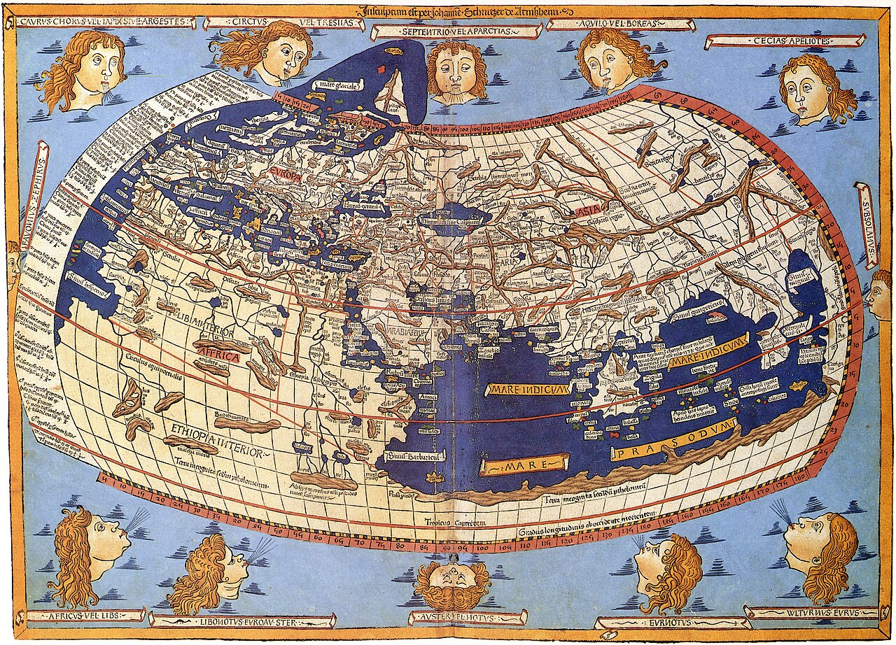
Lord Nicolas the German (Donnus Nicholas Germanus), cartographer Johann the Blockcutter of Armsheim (Johannes Schnitzer or Johannes de Armssheim), engraver |
||||
| Aozer | |||||
| Deskrivadur |
English: The world map from Leinhart Holle's 1482 edition of Nicolaus Germanus's emendations to Jacobus Angelus's 1406 Latin translation of Maximus Planudes's late-13th century rediscovered Greek manuscripts of Ptolemy's 2nd-century Geography. |
||||
| Deiziad | 1482 | ||||
| Mammenn/Luc'hskeudenner | Decorative Maps by Roderick Barron - ISBN 1851702989 | ||||
| Aotre (Adimplij ar restr-mañ) |
|
||||
| Stummoù all |
|
||||


Istor ar restr
Klikañ war un deiziad/eur da welet ar restr evel ma oa da neuze.
| Deiziad/Eur | Munud | Mentoù | Implijer | Notenn | |
|---|---|---|---|---|---|
| red | 31 Her 2023 da 09:26 | | 8 073 × 5 813 (18,03 Mio) | wikimediacommons>OnlySlightlyDamp | Reverted to version as of 03:58, 3 July 2007 (UTC) |
Implij ar restr
Implijout a ra ar bajenn da heul ar restr-mañ :